


Airbus renforce son portefeuille d’images d’observation de la Terre avec l’ajout de données satellitaires TripleSat
Catégorie: Communiqués, Données, Entreprises, Imagerie, Satellite/Spatial
Traduction libre par la rédaction de DécryptaGéo du communiqué de presse anglais
Toulouse, le 10 avril 2018 – Airbus a conclu un accord avec Twenty First Century Aerospace Technology Co. Ltd (21AT), opérateur de satellites commerciaux chinois, pour la distribution des images acquises par sa constellation TripleSat.
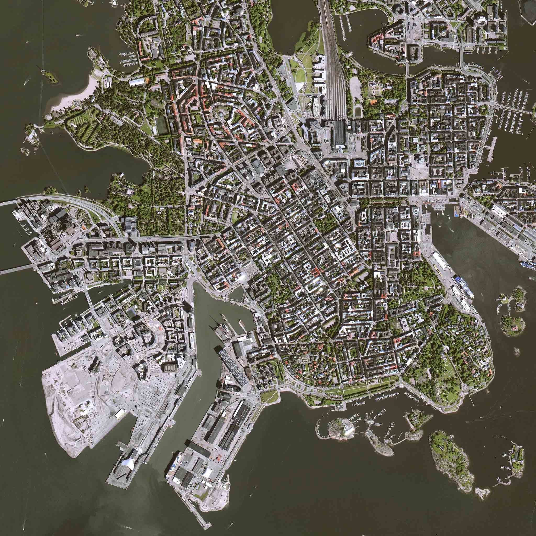
Helsinki_FINLAND_(c) 2017, 21AT Image, All rights reserved – Distribution Airbus DS
La constellation TripleSat est constituée de trois satellites identiques d’observation de la Terre à très haute résolution, espacés de 120 °, qui tournent autour de la même orbite. Ils offrent un suivi quotidien de n’importe quel endroit sur Terre révélant des détails de 80 centimètres. Les satellites ont été spécialement conçus pour cartographier les zones étendues et renforceront ainsi les capacités des satellites Pléiades et SPOT, améliorant l’accès à l’information dans les situations critiques.
Sur le plan optique, la constellation d’Airbus comprend déjà les Pléiades 1A et 1B à très haute résolution, les satellites haute résolution SPOT 6 et SPOT 7 ainsi que la constellation DMC. Du côté des radars, des satellites indépendants des conditions météo tels que TerraSAR-X et TanDEM-X ont récemment été rejoints par le satellite radar PAZ. La constellation est également renforcée par des partenaires satellites tels que KazEOSat. Ces partenariats complètent l’offre et le service pour des applications exigeantes.
Communiqué de presse original en anglais
Airbus further strengthens its Earth observation imagery portfolio with the addition of TripleSat satellite data
Toulouse, 10 April 2018 – Airbus has entered into an agreement with Twenty First Century Aerospace Technology Co. Ltd (21AT), the Chinese commercial satellite operator, for the distribution of the images acquired by their TripleSat constellation.
The TripleSat constellation consists of three identical very high-resolution Earth observation satellites set 120° apart, travelling around the same orbit. They offer daily monitoring of any place on Earth revealing details as small as 80 centimetres. The satellites were specifically designed to map large area coverage and will therefore reinforce the Pléiades and SPOT satellite capacities, improving access to information in critical situations.
On the optical side, Airbus’ constellation already comprises the very high-resolution Pléiades 1A and 1B, the high-resolution SPOT 6 and SPOT 7 satellites as well as the DMC constellation. On the radar side, weather-independent satellites such as TerraSAR-X and TanDEM-X were recently joined by the PAZ radar satellite. The constellation is also reinforced by satellite partners such as KazEOSat. These partnerships complement the offering and service for demanding applications.
About Airbus
Airbus is a global leader in aeronautics, space and related services. In 2017 it generated reported revenues of € 67 billion – or € 59 billion restated for IFRS 15 – and employed a workforce of around 129,000. Airbus offers the most comprehensive range of passenger airliners from 100 to more than 600 seats. Airbus is also a European leader providing tanker, combat, transport and mission aircraft, as well as one of the world’s leading space companies. In helicopters, Airbus provides the most efficient civil and military rotorcraft solutions worldwide.
Media contacts
Fabienne Grazzini + 33 (0) 6 76 08 39 72 fabienne.grazzini@airbus.com


 Communiqués